About Huntington Avenue Grounds
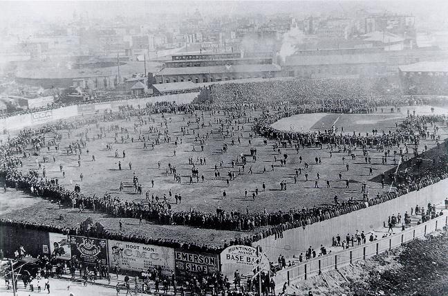
Huntington Avenue Grounds was an MLB stadium in Boston, Massachusetts. It opened in 1901, closed in 1911 and was demolished in 1912. Its last recorded capacity was 11,500. Its only tenant was Boston Americans (MLB, 1901–1911). On our ranked lists it ranks 33rd shortest-lived of 273 stadiums and arenas with known opening and closing years.
Appears in
Venue Information
Year Opened
Year Closed
Location
Elevation
3 m above sea level
Location derived from the venue's coordinates using data © OpenStreetMap contributors, available under the Open Database Licence (ODbL).
Elevation of the venue's coordinates from USGS and NASA SRTM elevation data, via Open Topo Data.
The site today
- The site is now part of Northeastern University.
From OpenStreetMap data near the venue's recorded coordinates, © OpenStreetMap contributors (ODbL). Maps show what is there now, not the old footprint.
Teams
| Team | League | Years |
|---|---|---|
|
Boston Americans While based here: 11 seasons · 850-781-24 regular season · 1 postseason trip (postseason results on record for 8 of 11 seasons)
MLB · 1901–1911
Boston Americans (1901–1907)
Boston Red Sox (1908–1911)
|
MLB | 1901–1911 |
Records are each team's full-season results while it was based here, home and away games alike, from final scores. They are not records of games played at this venue.
Frequently Asked Questions
What is the capacity of Huntington Avenue Grounds?
The capacity of Huntington Avenue Grounds is 11,500.
When was Huntington Avenue Grounds built?
Huntington Avenue Grounds opened in 1901.
What is on the site of Huntington Avenue Grounds today?
The site is now part of Northeastern University.
Where did the Boston Americans play after Huntington Avenue Grounds?
After leaving Huntington Avenue Grounds in 1911, the Boston Americans moved to Fenway Park in 1912.
Sources
Where the facts on this page were read from. How VenueStats compiles them.
- Open Topo Data (Public domain): Elevation.
- OpenStreetMap (ODbL): What stands on the site today.
- OpenStreetMap Nominatim (ODbL): Location.
- VenueStats compilation: Opening and closing years, name history and teams (compiled by VenueStats from Sports Reference and Wikipedia).
- Wikidata (CC0): Capacity, Coordinates (Wikidata places the building within 0 m of this point).
- Wikimedia Commons (Public domain): Photograph.
Location
Nearby Venues
| Venue | Years | Distance |
|---|---|---|
| Walpole Street Grounds | 1871–1914 | 0.1 mi |
| Boston Arena | 1910–2025 | 0.3 mi |
| Fenway Park | 1912– | 0.7 mi |
| Dartmouth Grounds | 0.9 mi | |
| Parsons Field | 1933– | 1.3 mi |
| Nickerson Field | 1915– | 1.6 mi |
Straight-line distance between the venues' coordinates.
References
Teams on Wikipedia
Every source for the facts on this page is listed under Sources.